TL;DR
Estimating from a ±6 mm point cloud tightens demo takeoff variance from 10–20% swings to ±3–5% and typically costs 0.2%–0.6% of project value. On a 92,000 sq ft Cincinnati brewery conversion it surfaced a 2.3-inch floor swing and two hidden timber beams — eliminating $148,000 in potential change orders and tightening the bid spread from 14% to 6%.
Bid Certainty Starts with Reality, Not Blue Lines
If you’ve ever bid a renovation off a 1970s vellum set, you know the feeling. Elevations don’t match the floor. A “typical” wall section is anything but. Your estimator takes a tape, a laser disto, a camera, and a prayer. Good effort—limited data.
We quit guessing years ago. We capture existing conditions before bid, and we hand estimators a measurable dataset they can trust.
That dataset is the point cloud.
What does a point cloud really give your estimators?
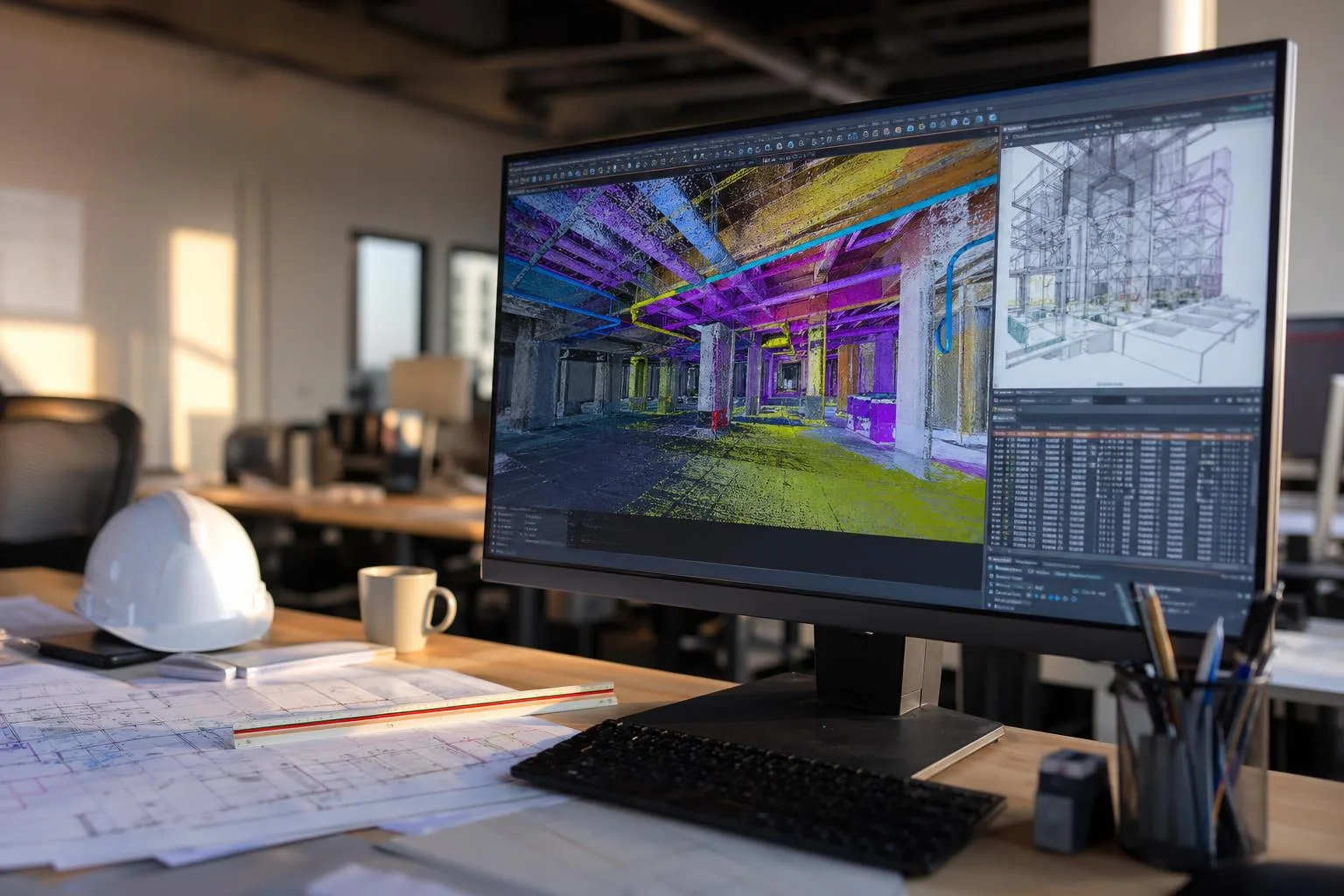
A point cloud is millions—often billions—of X/Y/Z measurements of every surface you can see. Walls. Deck. Beams. Ducts. Conduit. Tanks. Even the crown in an old concrete slab.
- Typical density with the NavVis VLX3: 5–10 mm spacing at 10 m
- Registered accuracy in occupied buildings: ±6 mm with survey control and QA
- Colorized points help finish identification and sequencing
- Deliverables drop into ReCap, Revit, Navisworks, AutoCAD, or your takeoff platform as E57, RCP/RCS, or LAS
Pair that with floor-by-floor pano views and you’ve got a living record, not a marked-up PDF. Our Building 3D Laser Scanning crews routinely scan and register data fast enough to influence the very first pricing exercise.
“Point clouds don’t remove every unknown. They remove the measurable ones—the ones that cause most of your change orders.”
How do we capture for preconstruction — and why does it matter to cost?
On-site method
- Mobile LiDAR with NavVis VLX3 for speed in open corridors and large rooms (walking pace capture)
- Terrestrial tie-ins with Leica RTC360 or FARO Focus in tight mechanical spaces and long, straight runs where angular accuracy is critical
- Cloud-to-cloud registration tightened with survey control targets in stair cores and long corridors
- Above-ceiling capture by opening representative tiles in corridors and nodes (with owner approval)
Throughput numbers we see repeatedly:
- 80,000–120,000 sq ft/day captured in largely open interiors with VLX3
- 15–35 terrestrial setups/day for mechanical rooms and shafts
- Typical dataset sizes: 40–120 GB per building wing; ReCap indexing 2–6 hours per wing on a modern workstation
Turnaround:
- Field capture: 1–3 days per 100,000 sq ft depending on density and access
- Registration and QA: 2–5 business days
- Estimator-ready exports: within 5–7 business days from mobilization
Estimating Workflows Directly From the Cloud
Demolition Takeoffs That Don’t Drift
- Measure interior partitions to the inch, including full-height vs. partial-height, and wall types inferred from thickness in plan slices
- Quantify floor finishes and underlayment removal by area; catch that 1/2” to 1” topping slab you didn’t know was there
- Calculate debris volumes for dumpsters using Volumetric Scanning; we routinely see ±3% variance when verified by weight tickets
- Flag structural elements to remain—columns, transfer beams, chevron bracing—so demo subs don’t lowball and rebid later
Hidden Conditions You Can Actually See
- Above-ceiling MEP: main duct trunks, VAV locations, sprinkler mains and drops, cable tray tiers; route counts inform demo and temp-services pricing
- Structural oddities: out-of-plumb shafts, offset beam pockets, and that cambered joist that kills your new branch duct
- Floor flatness and slope heat-maps for leveling allowances; we surface 1–2.5% slopes in pre-war buildings repeatedly
Early Clash Checks—Before the GMP
Feed the point cloud to design. Or have us create an LOD 200/300 Revit model via Scan to BIM and run overlays:
- Duct mains vs. existing beam depths and strap hangers
- New partitions against existing risers and conduit banks
- Equipment pads and access clearances—does that AHU really fit the well?
- Ceiling heights vs. lighting, sprinkler armovers, and VRF piping
Coordination at this stage replaces guesswork with geometry. It’s the cheapest time to move anything.
A Cincinnati Brewery Turned Office: Dollars and Days We Didn’t Spend
We scanned a 92,000 sq ft 1910s brewery in Cincinnati for an office conversion. Two days on site with a VLX3 and an RTC360 for the boiler room and long cellar corridors. 78 terrestrial setups, 9 control points, and 63 GB of colorized points. Registered to ±5.8 mm.
What the cloud showed:
- Floor elevation swing of 2.3 inches across a 140-foot open office bay
- Two 24-inch built-up timber beams concealed above a plaster lid—nowhere on the 1964 “as-builts”
- Sprinkler mains running 2 inches below the proposed soffit datum along the main spine
Pre-bid impact:
- Demo quantities adjusted by +11,400 sq ft of gyp and plaster removal
- Leveling allowance increased by 40 CY self-leveler, priced on the front end
- Duct sizing and soffit layout revised before MEP buyout
Measured results:
- 21 RFIs avoided in the first two months (we tracked what would’ve been asked on past conversions)
- $148,000 in potential change orders eliminated or priced in
- Bid spread tightened from 14% to 6% among three MEP primes because everyone priced the same geometry
We see similar gains on university and healthcare work. If you want a campus-scale example, this 12-building capture in 9 days shows how fast you can stabilize the estimate pipeline.
What can estimators pull — fast?
- Wall, ceiling, and flooring areas by level and zone
- Stair and shaft locations with true openings—not guesswork
- MEP main sizes and approximate lengths (duct/plumbing/electrical) for ROM estimates
- Slab step heights, curb heights, and dock elevations for FF&E and equipment fit
- Existing finish types for abatement planning and phasing
If you need 2D drawings to plug straight into your workflows, our Scan to CAD (2D AutoCAD drawings) and 2D/3D Floor Plans services deliver plans, RCPs, and sections with references back to the cloud. For full models, see Scan to BIM with LOD 200/300/400 options.
File Formats, Specs, and What to Ask For
We typically deliver:
- E57 master files per floor (10–25 GB each)
- RCP/RCS for ReCap/AutoCAD users
- LAS subsets for estimating platforms that prefer lighter data
- Panoramic view portals tied to point cloud stations
- Registration report with control residuals and QA screenshots
Want to write a spec that protects your budget? Steal from our playbooks:
- How to Write a 3D Scan Deliverable Spec That Protects Your Project
- Scope of Work Template for Scan to BIM Projects
When should you pull the trigger on scanning?
- Existing drawings are unreliable or missing (especially pre-1990 stock)
- Phased construction with live operations where access is constrained
- Tight interstitial spaces, low ceiling plenums, or major MEP rework
- Complex demolition scopes with abatement
- Budget certainty is non-negotiable—GMP target and tight contingency
- Multiple primes need to price the same geometry; see our work in construction, architecture, and engineering
ROI You Can Put in a Spreadsheet
- Typical interior scan cost: 0.2%–0.6% of project value on renovations
- One moderate field change (move a duct bank, reframe a soffit, demo/replace unforeseen gyp) can run $25k–$150k
- Data-led precon routinely trims 5–10% off demo and MEP allowance volatility
- Teams report 30–50% fewer site verification trips. See: How Architects Use 3D Scanning to Eliminate Field Visits
Walkthrough vs. Scan-Based Precon (Side-by-Side)
| Item | Traditional walkthrough | Scan-based preconstruction |
|---|---|---|
| Field time (100k sq ft) | 2–3 days, 2 people | 1–2 days, 2 people (VLX3 + RTC360 tie-ins) |
| Measurement accuracy | ±1–2 inches typical | ±6 mm registered |
| Above-ceiling intel | Spot checks only | Continuous geometry along routes |
| Demo takeoff variance | 10–20% swings common | ±3–5% with volumetrics |
| RFI volume (first 60 days) | 30–60 typical | 10–25 typical |
| Change order exposure | Priced contingencies | Priced scope with fewer unknowns |
| Deliverables | Photos, notes | E57, RCP, pano views, optional LOD 200/300 model |
Preservation and Adaptive Reuse Note
For historic structures, scanning supports—not replaces—traditional investigation. We pair point clouds with hands-on probes, material surveys, and historic research. That balance is what makes adaptive reuse feasible. If you’re studying a mill, theater, or courthouse, our teams work well with preservation architects; start with How 3D Scanning Supports Historic Preservation Documentation and our adaptive reuse services.
What is it like to work with us?
- Pre-field call to lock access, ceiling tile removals, and safety conditions
- Daily progress notes with floor coverage and any blocked spaces
- Registration and QA within 2–5 days; you’ll see residuals, screenshots, and a short punchlist of anomalies
- Estimator-ready packages in your formats
- Optional BIM for coordination, or 2D drawings for immediate buyout activities
- Clear, no-surprise pricing; we’ll tell you if we need to add terrestrial for a long datum run
If you want a fast read on speed and capability, see our Downtown Mansfield: 180K Sq Ft in 3 Weeks and Distribution Center: 250,000 Sq Ft in 4 Days. Both show how we keep capture at walking pace without losing accuracy. More gear and methods here: Our Technology.
Bottom Line for Precon Teams
- Stop bidding from assumptions. Start bidding from measurements.
- Use the cloud for demo, MEP routing, and fit checks—before the GMP.
- Bring owners a tighter price, fewer RFIs, and a smoother first 90 days.
If that’s your mandate this year, we’re ready.