TL;DR
At building scale the math is decisive: 180,000 sq ft takes 6–8 weeks by hand, 10–15 days with a tripod scanner across 800–1,100 setups, and 3–5 days with mobile LiDAR at ±6 mm. Tripods still win below 2–3 mm tolerance — use them deliberately, not by default.
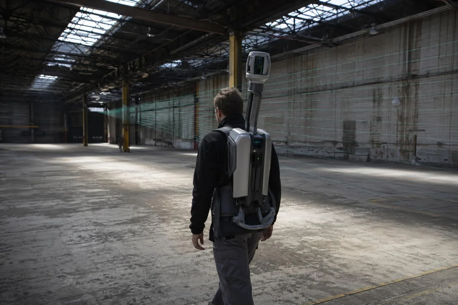
Large buildings don’t forgive slow documentation. When the scope jumps from a few suites to an entire facility, the method you choose decides whether you’re designing next week or still taping out corridors a month from now. For us, mobile LiDAR with the NavVis VLX3 has become the default for big interiors because it covers ground at walking pace while keeping accuracy where architects, engineers, and contractors need it.
The scale challenge no tape or total station can outrun
We still hand-measure small tenant fits, and we still run tripod scans where tolerances are tight. But scale changes the equation:
- 50,000 sq ft: hand measurement pushes into 2–3 weeks with multiple site days. A tripod scanner (Leica RTC360 or Faro Focus) trims that to 3–5 days if you’re disciplined on setups. Mobile mapping covers it in 1 day, 2 at most.
- 180,000 sq ft: hand measurement becomes a 6–8 week slog. Tripod scanning takes 10–15 days with 800–1,100 setups. Mobile LiDAR wraps it in 3–5 days with full panoramic coverage.
Point is simple: every extra setup, every tape pull, every corridor re-walk compounds. Mobile LiDAR breaks that loop.
“If it’s over 20,000 square feet and mostly interior circulation, we reach for the VLX3 first. It’s the only way to keep a renovation schedule honest.” — Field note from a January scan in Columbus
How does walking-pace capture actually work?
Mobile LiDAR mounts the sensors on the operator instead of a tripod. With the NavVis VLX3:
- Dual LiDAR sensors and four high-res cameras collect geometry and imagery as we walk.
- SLAM (Simultaneous Localization and Mapping) fuses the data in real time, then we tighten everything in registration.
- Typical interior point spacing: 5–10 mm at 10 m.
- Registered accuracy we stand behind: ±6 mm across floors when tied to control.
We route each floor with loops and vertical ties (stairs/elevators) to improve SLAM stability, then blend in exterior anchor scans with the Leica RTC360 or Faro Focus where longer range or façade angles matter. Registration is a mix of cloud-to-cloud with constraints, targets (spheres/checkerboards), and survey control. We QC residuals and loop closures and don’t release if we’re outside our ±6 mm target.
If you want a deeper look at the gear itself, this breakdown is a good start: Inside the NavVis VLX3.
Field notes from Ohio: 180K sq ft that didn’t wait around
Downtown Mansfield gave us a fun one: six connected historic buildings, 180,000 leasable sq ft, multiple grade changes, and active tenants. We ran:
- 4 field days with the VLX3 for interiors, plus 1 day of RTC360 for exterior façades and roof equipment ties.
- 2,050 pano images linked to measurement points in NavVis IVION.
- Registered point cloud delivery (E57 and RCP) in 7 business days; floor plan set in AutoCAD in 12 business days.
What it saved:
- About $38,000 vs. a tripod-only approach (field labor and mobilizations).
- Roughly 4 weeks on the design start.
- 22 RFIs avoided during schematic design because the panos settled material and layout questions without a return visit.
If you want the longer version, we wrote it up here: Downtown Mansfield: 180K Sq Ft in 3 Weeks.
Speed and coverage, with numbers that matter
- Capture rate: 35,000–60,000 sq ft per day in typical commercial interiors; hospitals and labs trend slower due to density.
- Deliverable timing (typical):
- Registered point cloud: 3–7 business days depending on size/complexity.
- Scan to CAD floor plans/sections: 7–15 business days.
- Scan to BIM Revit models: LOD 200 in 10–20 business days; LOD 300 in 20–35 business days for large sets.
- File sizes:
- 50K sq ft: 25–45 GB E57, 500–900 pano images.
- 180K sq ft: 120–180 GB E57, 1,500–2,200 pano images.
What do you actually receive?
From a single mobile run we deliver:
- A unified, registered point cloud (E57, RCP, LAS) you can open in Autodesk Recap, Revit, or Civil 3D. If you’re unsure which to pick, this explainer helps: Point Cloud File Formats Explained.
- Panoramic walkthroughs tied to scan positions for remote verification.
- 2D drawings or full models:
- 2D/3D Floor Plans and elevations for early design and permit packages.
- As-built Revit models at LOD 200/300 via Scan to BIM.
- Measurable context for estimating and coordination. We routinely see precon teams reduce site revisits to near zero.
When is mobile LiDAR the right call?
Use mobile mapping when you need:
- Large-area interiors (20,000+ sq ft) captured without hundreds of tripod setups.
- Occupied buildings documented without blocking corridors or moving people out of their space.
- Multi-floor connectivity and vertical relationships captured in a single, continuous dataset.
- Quick turn to kick off as-built documentation or a feasibility study.
- Early design accuracy at ±6 mm that holds up through schematic and DD.
When does tripod-based terrestrial scanning still win?
We still drag the tripod when the job demands it:
- Tolerances under 2–3 mm: machine bases, structural steel fit-up, jigs, precision alignment.
- Tight MEP areas where we want ultra-dense static scans for complex surfaces.
- Exteriors and façades where long-range incidence angles and control lines matter.
- Industrial process plants with heavy occlusions and safety access limits.
Most large projects end up hybrid: VLX3 for speed and coverage; RTC360 or Faro Focus for detail anchors. That combination keeps cost and time in check without sacrificing what the design team needs. For why GCs lean this way, see: Why General Contractors Are Standardizing on Scan to BIM.
The panoramic advantage: fewer RFIs, fewer site days
Geometry answers “how big?” Panoramas answer “what is it?” That second answer kills a lot of uncertainty.
- Architects confirm door swings, glazing types, and ceiling conditions without a re-visit.
- Engineers trace duct runs and identify equipment plates from the desk.
- Estimators pull quantities and verify access routes faster, which tightens budgets early.
We’ve watched RFI counts drop in early design phases simply because everyone can “stand” in the room from their browser.
Accuracy and QA: how we keep ±6 mm honest
- Control: We set survey control per floor and tie vertically with total station shots.
- Targets: Spheres/checkerboards in long corridors and large volumes to stabilize registration.
- Registration: Cloud-to-cloud with constraints; loop closures to catch drift; QA on residuals and heat maps.
- Checkpoints: Independent check shots per floor; we publish residuals with the deliverable when requested.
That’s how the dataset holds together across a multi-building campus. We’ve used the same approach on healthcare, higher-ed, industrial, and historic properties.
Side-by-side comparison for big interiors
| Scenario | Method | Typical Field Days | Setup Count | Registered Accuracy | Notes |
|---|---|---|---|---|---|
| 50,000 sq ft office | Hand measurement | 10–15 | N/A | N/A | Multiple re-visits, incomplete geometry likely |
| 50,000 sq ft office | Tripod TLS (RTC360/Focus) | 3–5 | 250–400 | ±3–5 mm | High detail, slower progress |
| 50,000 sq ft office | Mobile LiDAR (VLX3) | 1–2 | 0 | ±6 mm | Walk-through capture with panos |
| 180,000 sq ft campus | Hand measurement | 30–40 | N/A | N/A | Schedule killer |
| 180,000 sq ft campus | Tripod TLS (RTC360/Focus) | 10–15 | 800–1,100 | ±3–5 mm | Multiple mobilizations |
| 180,000 sq ft campus | Mobile LiDAR (VLX3) | 3–5 | 0 | ±6 mm | One mobilization, full pano coverage |
Numbers above are from our field logs. Building complexity, access, and safety rules can push times up or down, but the order-of-magnitude difference holds.
How does this play out downstream?
- Design start: With a registered RCP/E57 in under a week, your team can model sooner. That moves SD/DD milestones up by days to weeks.
- Coordination: A clean point cloud reduces guesswork. We see fewer change orders tied to “unknown existing.”
- Estimating: Quantities and conditions are visible, so budgets stabilize earlier. See our workflow: Preconstruction Estimating with Point Cloud Data.
If your end goal is a Revit model, we’ll define scope up front (LOD 200 vs. 300, tolerances, what’s “modeled vs. annotated”). This guide helps owners and architects write scopes that avoid surprises: Scope of Work Template for Scan to BIM Projects.
Picking the right tool for your building
If you manage a 30,000 sq ft school, a 250,000 sq ft distribution center, or a multi-building healthcare campus, mobile LiDAR usually gets you to design-ready data fastest. That doesn’t make tripod scanning obsolete; it means you use it deliberately where it pays off. The best outcomes come from teams that understand both and aren’t loyal to either.
For a look at scale in practice, this distribution facility went from empty shell to coordinated model on a compressed schedule: Scanning a 250,000 Sq Ft Distribution Center in 4 Days. Or, if you’re starting from scratch on a building program, our overview of Building 3D Laser Scanning lays out deliverables and typical timelines.
Ready to talk specifics? Send a floor count and square footage, tell us your deliverable (RCP/E57 only, Scan to CAD, or full Scan to BIM), and we’ll tell you how many days and what it’ll cost—without guesswork.